
A foggy view along the trail near Mill Run, photo credit: Nick Biss
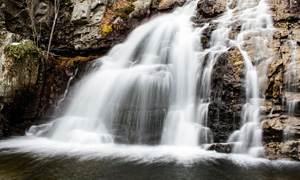
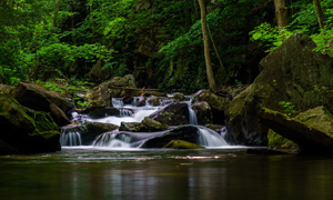
Among the trail enthusiasts of Pennsylvania, the Laurel Highlands Hiking Trail (LHHT) needs little introduction. Stretching from the heart of Ohiopyle State Park to the depths of the Conemaugh Gorge, this 70 mile trail makes up the northernmost section of the Potomac National Heritage Trail; it’s no surprise, then, that LHHT treks through significant American history. The trail follows a stray ridge of the Allegheny Mountain range that bears many names: Laurel Hill, Laurel Mountain, and Laurel Ridge. There’s something for everyone along LHHT, as the trail passes by spectacular vistas, mystical stream crossings, playful rock formations, and diverse vegetation.
LHHT passes through Fayette, Somerset, Westmoreland, and Cambria counties. Most of the trail is on public lands, including Ohiopyle State Park, Laurel Ridge State Park, Forbes State Forest, and State Game Lands 111 and 042. The trail goes through private land only twice, briefly through Greater Johnstown Water Authority and notably through Seven Spring Springs Mountain Resort.
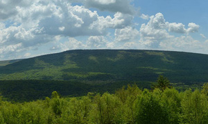
There rests upon Laurel Ridge an undeniable, intangible allure that invites up to 113,000 visitors to its namesake state park every year. People love this hill, so much so that the trail has only grown in popularity over time. This year, 2026, the Laurel Highlands Hiking Trail is celebrating its 50th anniversary. After half a century of service, it is worth looking back at the history of the mountain, the state park, and the trail itself. This is a love story, and it begins long before any trail formally existed.
The First Inhabitants of Laurel Hill
The first people to explore the ridges and valleys of Pennsylvania were indigenous people. The earliest evidence of civilization that we have from Laurel Hill is from Paleo-Indians around 10,000 B.C.. Then from about 8,000 B.C. to A.D.900, semi-sedentary hunters roamed the region. The first known named society in the region was that of the Monongahela people. Between A.D.900 and 1,000, the flood plains and hill tops of the ridge were dotted with their villages. They relied heavily on subsistence agriculture, farming, among other things, corn, beans, and squash. Of course they hunted as well; recovered bows and arrows appear to be the weapon of choice against game like the now-extinct passenger pigeons and elk.
Some time after the Monongahela people inhabited these lands, the Iroquois took over. They didn’t settle the region, but used these lands for hunting and gathering. For a long time, Laurel Hill had no permanent human populations. The region was settled once more by A.D. 1630, when the indigenous peoples were first greeted by European settlers. Lenape (Delaware) and Shawnee settlements were displaced as European settlers expanded into the region, bestowing upon two villages the names of Conemaugh Old Town and Loyalhanna. These villages would later become Johnstown and Ligonier respectively.

Laurel Hill Lumber Co train
Unfortunately not much else is known about the local indigenous history of the land. They were displaced, forced west over the hill during the first half of the 18th century, carving paths over the ridges in the search of a new home. The Europeans that settled the land generally made ends meet through agriculture and local artisanal trade. During the peak of the stone iron furnaces from 1790 to 1860, quarries were carved into the hillside to provide stone to construct the furnaces, while the plentiful waterways powered the bellows, supplying oxygen to the raging fires within that consumed an acre of forest per day, each. Thus began the first stages of deforestation on the hill. Iron gave way to steel, and with the advent of railroads, more of Laurel Hill was available for harvest. Wood wasn’t just needed to fuel the furnaces, but build the homes and prop open the mines of the people working them. By 1940, the hill was almost completely clearcut. Throughout this time, many of those indigenous-made paths over Laurel Hill were converted into major roadways for trade, and railways sprung up, connecting the ridges and valleys into a lumber – and then steel – producing monolith.
Origin of the Trail
Reckless resource extraction hardly seems like a labor of love for the land. Not every businessman respected this ridge, but the residents on and around it certainly did. For example, there were four families that gathered almost every weekend at their cabin on Laurel Hill for picnics and pastimes; The Thomas’, Corbins, Springers, and Mayers had a friendship spanning generations. Their sons, Fred Thomas III, Doug Corbin, and Bruce Springer, were energetic Boy Scouts that spent their youth aimlessly exploring the slopes of Laurel Hill, biking past the sunset until being scolded by their parents.
For Fred, leisurely meandering on the mountain developed into a targeted desire for discovery. Growing up on St Clair Road, he’d often gaze upon Laurel Mountain, noting the ridge that stretched between the fire towers. After fifteen years, he couldn’t ignore the call of adventure. A single thought overtook his mind: “Boy! That would be a nice piece to try to walk.”
Fred shared his idea with Doug and Bruce, who found the idea equally appealing. They got to work gathering topographic maps and sketching a route that would follow the length of the ridge. The three Boy Scouts were eager to sharpen their survival skills, but their parents were none-to thrilled at the thought of their unsupervised sons spending days out in the wilderness. The boys needed a chaperone.
On April 1, 1968, the trio presented their carefully crafted commute to James (Jim) E. Mayer. Jim worked as an attorney in Johnstown, and was an avid outdoorsman, hiking almost every weekend. His experience and existing relationship with the boys would make him a perfect chaperone for this adventure. But would he agree to their plan? According to Fred Thomas, it took Jim just a few days before giving the boys his answer: “Okay, I think this is doable.” Jim knew something that the boys did not: They were not the first people to want to hike the ridge.
Enter the Western Pennsylvania Conservancy (WPC). WPC is a non-profit dedicated to, “the preservation of areas of scenic, geological, biological, historical, and recreational importance in western Pennsylvania.” WPC identified Laurel Hill as one such place of importance, and set out to acquire as much of the land as possible. This was not WPC’s first rodeo with land banking; at this point they’d added 2,000 acres to McConnells Mill State Park and 2,300 acres to Moraine State Park. Laurel Ridge, however, was going to be their biggest project yet. They didn’t just want a State Park – they wanted a hiking trail. A trail that would highlight the intrinsic value of nature. A trail that would encourage a new generation of environmentalists. A trail that would span the entire ridge, 58 miles of peaceful, restorative recreation. A trail that would withstand the test of time.
Hiking, and especially backpacking, were not always such mainstream pastimes. The people who did enjoy the activity were few but passionate. Volunteer groups would speak with private land owners to informally secure permission to route a trail through their property, and this led to the successful creation of many community driven trails, including the Appalachian Trail. However, times were changing. Americans were growing tired of the repetitive droning of suburban life, some calling it “unbearable” in newspaper interviews from 1971. More and more young adults wanted nothing more than, “to get away from society.” They found relief in the great outdoors. One reporter found that, “they speak to the absolute sense of freedom to be experienced in the wild.” And what better way to get outside than to go out on a trail?
Hiking can be enjoyed alone or with the whole family, trails difficult or easy, and exercise easily controlled by merely changing one’s stride. And aside from food and perhaps some outdoor equipment, there is no price to enjoy the activity. It is no wonder, then, that there was a backpacking boom. One survey even estimated that one in ten Americans at the time had tried backpacking themselves. One reporter even reported that, “Every manufacturer or retailer to whom I spoke reported that sales doubled in the last 3 to 5 years.”
The increasing number of hikers brought along an increase in conflicts with private land owners. “A Hiker’s Guide to the Laurel Highlands Trail” words it quite well; “It was one thing for a remote farmer to grant informal permission for a few hundred people per year to walk across his woodlot; it is quite another thing for a second-home development corporation to grant permission for many thousands of people per year to walk across its $2000 ¼-acre lots.” As the toll to landowners increased, many of the informal agreements with trail clubs came to an end, and once beloved routes needed to be rerouted at impossible speeds. The fates of many of these trails were in jeopardy.
Imagine, then, how important it was to have trails that were formally routed and protected, that wouldn’t have to undergo major changes based on the whims of neighbors. That is exactly the sort of trail WPC sought to create. By having most of the trail on publicly owned lands, there would be no risk of landowners changing their minds about who’s allowed on the trail, allowing it to remain a constant source of recreational enjoyment for all. At the time, WPC referred to this future state park as the Laurel Ridge Connector Park, because it was meant to “connect” the various State Parks, State Forests, and State Game Lands into a continuous stretch of public land from the Youghiogheny River to the Conemaug Gorge via public lands.

Photo of a land ownership map from “A Hiker’s Guide to the Laurel Highlands Trail.” Photo taken by Eleanor Meckley on 1/15/2026.
Some of the land WPC acquired was through donations; WJAC, Inc. and Bethlehem Steel Corporation donated land for this project. The rest of the land they purchased, but there were two things that WPC had going for it at the time. For one thing, the land was barren from logging and mining, and had dropped significantly in value. The other point was that WPC had received a one million dollar grant from Richard King Mellon Charitable Trustees, and so for only $2-$5 per acre, the total land owned by WPC came to 11,230 acres. By November 1, 1968, those 11,230 acres were sold to the State.
The State purchased this land from WPC using funds from Pennsylvania’s Project 70 Land Acquisition and Borrowing Act (more simply known as “Project 70”), which was signed into law on June 22, 1964. Project 70 was a $70 million bond initiative that authorized the State to acquire, “land for State parks, reservoirs and other conservation and recreation and historical preservation purposes.” Of course, Laurel Ridge State Park wasn’t done yet – the Department of Forests and Waters purchased the remaining 2,395 acres to bring Laurel Ridge State Park to the size it is today.
Unfortunately, the resounding success of the Conservancy to preserve the land on Laurel Hill was not without significant sacrifice. Many people on the Hill had made their home there, some homesteads dating back centuries. In order to create the exceptional Laurel Highlands Hiking Trail, the State exercised eminent domain under Project 70, displacing people and communities, and in some cases nearly erasing their histories. Some towns, like Ohiopyle, went from bustling communities with “hotels, boardwalks, and ball fields” to mere supplements of the state park. Other communities, like Victoria, Bidwell, and the Laurel Hill Settlement, were almost completely erased, with only a few hidden landmarks remaining as tangible artifacts of their history. Dane Cramer has written about this history in his book “Romancing the Trail.” WPC has funded the research of the Laurel Hill Settlement to record its history, which can be read about at https://storymaps.arcgis.com/stories/c0549294d58942bdacce617c8026aaea
Jim Mayer was a member of the Western Pennsylvania Conservancy, and was receiving updates on the plans to create the “Laurel Ridge Connector Park” and the corresponding trail right around the time Fred Thomas, Bruce Springer, and Doug Corbin approached him with their plan. While the boys had a skeleton of a plan for their hike, Jim filled it out. He wrote to WPC to acquire maps of the proposed trail. Al Pratt from the Department of Forests and Waters was instrumental in designing this first iteration of the trail, when he heard about this first planned thru-hike, he was ecstatic. He asked the team for their suggestions and feedback on the route after they did their hike, in particular asking them to locate any springs that could provide water to campsites. Even this early in the trail design process, he felt that the camp sites should be off of the main trail with their own service roads for cleanup.
On June 12, 1968, Doug Corbin, Bruce Springer, Fred Thomas, and James Mayer assembled at the fire tower at the top of the hill on Decker Avenue to begin the first ever thru-hike of the yet-unnamed Laurel Highlands Hiking trail. They only had their compasses and the map from WPC to aid in their navigation. Their square-shaped aluminum frame backpacks carried freeze-dried foods, a few changes of clothes, and a piece of black plastic that they would tie up for overnight shelter. They had no water filters, and needed to boil anything they filled their canteens with. They had set up a single food cache about halfway through their planned route at Route 31 – a cardboard box secured in a tree with an official-looking label that stated “Private property. Do not touch.”

The map used by the first people to thru-hike Laurel Ridge. Image provided by Teresa McConnell.
The journey was not an easy one. The group was forced to walk along utility right of ways, roads, and generally any path to avoid the un-treckable wilderness of the ridge. Difficulty turned to danger at the Pennsylvania Turnpike. The Laurel Highlands Hiking Trail did not exist, and neither did a bridge across the Turnpike. They approached the highway near the old turnpike tunnel, scrambling down the sheer gravel cliff to reach the side of the Turnpike. Then they waited, hiding on the side of the road until there was a chance to cross. Doug Corbin remembers that, “When we crossed the Turnpike, gosh… must’ve been ten lanes of traffic!” When the roar of traffic dulled to a quiet hum, they all at once sprinted across the road, practically diving back into the woods on the other side.
In addition to the obvious danger of crossing such a busy highway, what the group did was also highly illegal. Jim celebrated the crossing by naming their group the Turnpike Crossers Anonymous (TCA). However, the name was a slight misnomer. Jim was widely considered to be a great guy, the kind of friend you could rely on for help when things went south. It’s no surprise, then, that he had in fact reached out to the commissioner prior to the hike to get permission to make this monumental crossing. Even so, the group wore their TCA label with pride.
Though TCA had successfully crossed the most dangerous obstacle on their path, their struggles were far from over. While they had packed calorie-dense dehydrated foods for their journey, there was simply no satiating the hunger of the teenagers. Things got especially rough when they couldn’t find water for almost a full day. Their salvation came by the “Welcome to Seven Springs” sign, where a bubbling spring filled their canteens, which they quickly boiled back at camp to rehydrate. Later, they came across Cranberry Lake, which proved to be completely un-navigable. They ignored their map, which had them going straight through the obstacle, and instead stitched together a route from various pipelines and utility roads to get around the lake.
Finally, on June 17, 1968, TCA completed the first ever thru-hike of the Laurel Highlands Hiking Trail. They stepped off of the trail with blistered feet and weary limbs, and though their packs were empty of food, they walked away much more than they started with. Every one of the TCA members looks back on this hike fondly. Fred Thomas felt accomplished to have his crazy plan come to fruition. “I was narrow minded, looking for an adventure,” he said. “I just love the outdoors. I love all the interesting things along the ridge. It’s an amazing piece of topography.” Doug Corbin remembers, “a number of amazing sights,” and recounts all of the trials they surpassed with a smile on his face. And for Bruce Springer, he specifically recalls the pleasure of the company. “Jim Mayer was always a lot of fun,” he said. “It was a real pleasure to take that hike with him.”

The TCA after finishing the first hike of the Laurel Highlands Hiking Trail in 1968. From left to right are Bruce Springer, Fred Thomas, Doug Corbin, and Jim Mayer. Photo shared from Teresa McConnell.
Jim earned himself a title all his own following that hike: The Fearless Leader That Followed. Fred, Doug, and Bruce were teenagers in pretty good shape, and Jim Mayer was a middle-age man who often found himself straining to keep up with their limitless energy. Even so, he was always eager to help out his friends at TCA. “He was very generous to give us all that time,” Fred said. He explained that their parents were all busy working, and no one had the time nor inclination to spend days out in the wilderness with them. Jim didn’t just chaperone their trip, but really planned ahead with it, thinking about what it could grow into. During the hike, TCA had annotated the map they got from WPC, scratching X’s over locations with interesting sights or useful resources like water access. Additionally, they drafted a memorandum to the Director of State Parks Commonwealth of Pennsylvania with observations from their excursion, as well as offering suggestions on how the trail should be routed. Jim’s careful planning turned this spontaneous summer adventure into the groundwork for what would ultimately become one of the most beloved trails in the state.

A placard celebrating Jim Mayer’s leadership of the first hike of the Laurel Highlands Hiking Trail. Image provided by Christine (Chris) Mayer Bragg.
On January 7, 1969, the secretary of the Pennsylvania Department of Forests and Waters, Maurice K. Goddard, wrote letters to TCA thanking them all for the memorandum, and saying, “You will be interested to know that our project planners have found the data collected by you and your associates to be extremely helpful in their design concepts for the trail.” Later that year, the State hired Neilan Engineers of Somerset to design the trail. At the same time, WPC convinced the Department of Forests and Waters to create a, “task force for the purpose of on-site evaluation, location and recommendations for shelters, camp sites, commercially operated hostels, water sources and auxiliary facilities.” By January 19, 1970, Neilan Engineers had already routed the first section of the trail from Route 31 to Route 653, but wanted the task force to provide further suggestions/revisions. The task force was instructed to do just that, as well as, “consider the aspect of availability for shelter areas in terms of a jeep road which can take out litter, and a road wide enough for a basic well drilling rig to get into the shelter site.” Neilan Engineers did a great job, and by June 1970 the southern portion of the LHHT was completely routed.
Jim was heavily involved with the routing of LHHT, in near constant communication with the people in charge. At the end of 1970, he became aware of an awkward issue. While everyone was celebrating the good work WPC did getting so much public land for the hiking trail, it had slipped their minds to reach out to one of the private land owners whose land the trail was routed through. For a short distance, LHHT dips into the property of the Greater Johnstown Water Authority. No one expected any resistance from them to routing the trail, but the complete lack of contact with them caused offense. “I gather… that at least some members of the Authority view it as somewhat presumptuous of the Conservancy, the Department of Forests and Waters, and the local interests, to proceed on the assumption that the water shed area will be available for hiking trails,” Jim wrote to warn WPC of the potential trouble. He offered a suggestion to address the issue: “I believe the Authority members should be invited to a dinner meeting… at which a full scale presentation of the plans for this park… can be made. Lots of maps, photographs and projections,” he added. WPC took his suggestion, and on February 18th, 1971, they held a meeting with the Authority. To call it a success would be an understatement; “we have a green light to do just about anything we want so long as we stay well up the mountain,” Jim wrote many times in letters he sent out to the various involved parties in thanks of their efforts.
After the southern portion of the trail had been routed, WPC asked Jim Mayer to assemble and lead a new task force for the northern end of the trail, a request with which he was all too happy to comply. He assembled a team of about a dozen people, including TCA, and they got to work later that year.
While the task force and Neilan Engineers worked to route the rest of the trail, State Park personnel got to work on constructing what had been done. Funding for the trail construction came from the Land and Water Conservation and Reclamation Act. Robert (Bob) Hufman was the Laurel Ridge Superintendent, and oversaw the construction of LHHT, along with Jerry Yocum. The two men would go out on the Hill, following the topographic maps from the task force and Neilan Engineers. They would indicate the path of the trail by tying ribbons to the branches of trees. A trail crew would then clear large obstacles. They would use chainsaws to tackle trees, logs, and shrubs, and any boulders that blocked their path would either be smashed via sledgehammer or demolished via dynamite.

LHHT Trail Crew 1973, image provided by DCNR.
After a primitive trail had been carved through the vegetation, the trail crews would come back with fire rakes and shovels to cut the trail into the ground by removing smaller obstructions like roots and rocks. Even then, the trail wasn’t done. On steep hillsides, stone steps, switchbacks, and/or anchored barriers need to be installed to reduce erosion. Bridges would need to be built over water crossings, usually by finding a tree of the right size that’s out of sight of the trail, cutting it down, splitting it in half, dragging it into place, and pinning it down with nearby rocks or spikes whittled from its branches. And of course, they had to paint the yellow blazes. Much of the trail construction was accomplished by teenagers working summer jobs, college-age “country boys” anywhere from 17 to 19 years old.
Most of the people on these trail crews had little idea of the significance of the Laurel Highlands Hiking Trail. Many of them only found out about the job opportunity from their parents, and from there they just did as they were told; They followed the ribbons and dug the trail. One of the workers, Sam Bowers, admitted that, “back in that time there weren’t too many people into the hiking thing that we knew, and we thought ‘this is kind of crazy. We’re gonna go through all this work and nobody is ever going to use it much.’” Despite that, this job is one that many look back upon fondly. “It was probably one of the best jobs I had,” said Vern McCulley. “We had a lot of fun, we had a good crew, and we all got along together. It was just good work,” he concluded. Even gruelling manual labor became an action of passion as these boys fell in love with the Laurel Highlands themselves.
Meanwhile, the Department of Forests and Waters was hard at work designing the shelter areas that would come to be a defining feature of LHHT. LHHT was always meant to be a more accessible hiking trail. “The trail is being built not only for the rugged individual hiker, but the elderly and children as well,” Bob Hufman said in 1972. The shelter areas were a major part of achieving this goal. The shelter areas were spaced 6-12 miles apart along the trail, a reasonable distance for even the most leisurely-paced backpacker to achieve in a day. Each shelter area is equipped with five Adirondack style shelters that sleep six, space for 30 tents, two latrines, and a water supply. The Adirondack-style shelters are rustic, three-sided shelters with a large stone fireplace. Their goal was to use materials and designs that would blend in with the natural landscape. That, in addition to being physically removed from the trail, would give LHHT a remote aesthetic while still providing quality amenities to make the trail more accessible. “Once they built the shelters,” Bowers explained, “people really started really getting interested… so then you can see that it was gonna be something people would use.”
By September 1972, 30 miles of the trail were cleared, blazed, and open to day hikers. By 1974, the first three shelter areas out of a planned eight were completed, and in May the first 32 miles of the trail from Ohiopyle to Route 31 were officially opened. A year later that number grew to 57 miles, with two additional shelters completed by the end of June. Finally, in 1976, the whole 70 mile trail was done, complete with eight shelters.
History of the Laurel Highlands Hiking Trail
Many of the trail crew workers were pleasantly surprised by the popularity of LHHT. “Who would ever have thought that it would be such a tourist attraction?” Ronnie Pritts, one of the workers, remarked. In reality, the Laurel Highlands Hiking Trail was always intended to be a popular trail. As early as 1968, the secretary of the Department of Forests and Waters, Dr. Maurice K. Goddard, said, “The number of people using hiking trails is almost incredible and we know that, considering emphasis on physical activity, it is going to become a great factor in the future,” predicting heavy use of LHHT specifically. In Fall 1972, only 30 miles of LHHT were cleared and blazed, but with no completed shelter areas, only day hikers were allowed. Even so, about 60 people were on the trail every weekend. By 1975, 17,000 people registered at the three registration posts along LHHT. Mayer wrote to his state senator that, “This is unbelievable even to those of us in the business.” In the first year of the trail being fully opened, 75,000 hikers took advantage of the opportunity. By 1990, that number was 86,000. In 2003, the Laurel Highlands Hiking Trail was named the 10th best trail in the country on Trails.com, and recent years have seen as many as 113,000 visitors to Laurel Ridge State Park.

Runner on the Laurel Highlands Ultra. Photo by John Gregorchik.
Hikers and backpackers weren’t the only ones flocking to the Laurel Highlands Hiking Trail; the trail’s popularity with runners continues to grow spectacularly, thanks to the Laurel Highlands Ultra. The story of the Laurel Highlands Ultra begins with two brothers, Joe and Paul Butchko. These outdoorsmen loved running – Paul was a race director for a 50 miler held in his hometown of Greensburg for several years – and when they discovered the Laurel Highlands Hiking Trail in the mid 1970s, it became a favorite place of theirs to run. Naturally, when the trail was completed in 1976, they tried to run the whole 70 miles. They failed in this endeavor, but these men weren’t quitters. They tried again the next year, and the next. Some of their friends even joined in their attempts. Then, in 1979, Paul Butchko passed the 70 mile marker, successfully running the entire trail.
Paul’s success proved that the feat was possible, and if it was possible, it could be official. Paul put on his race-director cap, coordinating the first official Laurel Highlands Ultra. It was just the Butchko brothers and a few friends and family, for a total of nine registered racers. On June 14, 1980, eight people started running in Ohiopyle, and by the end of the day, four of them had triumphantly crossed the finish line.

Results of the 1980 Laurel Highlands Ultra. Courtesy of Ted Massa.
The Laurel Highlands Ultra became an annual event. Joe Butchko became the official race director, completing the necessary paperwork to run the event. Paul Butchko continued his work as the official timer. Their friend, Ted Massa, managed the registration paperwork for wanting participants. The popularity of the Laurel Highlands Ultra continued to grow, but the Butchkos couldn’t keep running the event forever. They announced that 1999 would be their last year coordinating the race, and by the time racers were crossing the finish line that summer, no replacement coordinator had been found. Many thought that this would be the final year of the Laurel Highlands Ultra.
Thankfully, the community stepped up. Tim Hewitt, Loreen Hewitt, and Rick Freeman took over coordinating the race, while many others began helping out in smaller capacities. Instead of marking the end, the year 2000 ended up breathing new life into the Laurel Highlands Ultra. The race coordinators created the first website to organize and promote the event.
The Laurel Highlands Ultra is now a qualifying event for the Western States Endurance Run, a 100-mile run starting in Squaw Valley, California. This attracts even more people to Laurel Hill to run the race. “People consider it to be one of the best,” said Mike Mumau, former manager for the Laurel Hill State Park Complex. The entry list for the Ultra fills within hours. In 2025, runners from 23 states and four countries were registered for the race, and the waitlist was over 200 people long. In addition to the 70 mile Laurel Highlands Ultra, the second Saturday of June also hosts a 50K. There are relay versions of both of these races as well.
There’s a lot that sets the Laurel Highlands Ultra apart from similar races. While most races are on Jeep roads, the Laurel Highlands Ultra is almost entirely single-track trails through the wilderness. Ted Massa speculates that, “I think people found that it was just so much more enjoyable and still challenging.” The reputation among trail runners is that LHHT is a hard but beautiful trail. Massa claims that while many races are advertised as trail races, and yet they have miles and miles of plain dirt roads. “Something like Laurel I think is a real trail race,” he concluded.
Another unique trait about the Laurel Highlands Ultra is that it’s the longest consistent race in the United States. It even happened during the COVID-19 pandemic in 2020. The Hewitts and Freeman had just retired from directing the Laurel Highlands Ultra, and passed the responsibility onto a company called Red Point Productions. 2020 was to be their first year coordinating the race. The Laurel Highlands Ultra is always on the second Saturday of June, but that was at the height of the quarantine in 2020. Red Point opted to delay the event until September instead of cancelling outright. By September, the dangers of COVID-19 were still widely unknown and feared, but Red Point pressed forward. To reduce the risk of spreading disease, the start times for racers were staggered. Rules about who was allowed to help at aid stations along the trail were refined for the pandemic. Thanks to their careful planning, many runners were able to get outside and celebrate this beloved trail with their community at a time where loneliness and isolation were at an all time high.
Red Point Productions implemented a new requirement upon those who wished to run the race. Each participant is required to volunteer eight hours maintaining a trail. This is a common practice among Ultra races, the thought being that, if you’re using the trail to race on it, you ought to give back somehow. Trails, once built, do not last indefinitely without great care. “Bridges rot. Roofs leak. Shelters and trees fall. It’s constant work,” Ted Massa explained bluntly. To maintain 70 miles of trail is no easy feat, but the staff at Laurel Ridge State park have always done remarkable work keeping LHHT accessible to so many. They don’t stop at maintaining high quality– they are always striving to improve the trail in whatever way they can.
A common example of small improvements to the trail are reroutes. The most typical cause of reroutes is if the trail goes through a really swampy area. Places that weren’t marshy before become marshy with excessive use, and the ever-popular LHHT, “had been loved to death in many places,” according to Mike Mumau. Between miles 41 and 43 of the trail is especially marshy, so several minor reroutes have occurred there. Another reason for minor reroutes is for convenience. Maintenance staff will identify areas that are a bit too steep, for example, and install a nearby switchback to make the trail safer.
As for more significant reroutes, most have had to be done on the Seven Springs land. As the ski resort developed the land, new ski trails, condos, and parking lots interrupted LHHT, so it needed to be routed around the new obstacles. Most distance trails cover a great deal of private land, where these developments happen in too many places too fast for maintainers to be capable of promptly addressing the issue. The fact that Seven Springs is the only spot on LHHT with this issue makes it easy for park staff to clearly communicate with the land owners to quickly find a solution to reroute the trail. What’s more, park staff took advantage of the opportunities to reroute the trail towards more stunning views and through more primitive wilderness, compared to the developed ski slopes.
There was a significant 1.25 mile reroute of the trail around mile 61 in 2018. This section of the trail had followed a dirt road, which nobody liked. It was too hot, sunny, and boring. This was on state game lands, so the manager of the Laurel Hill State Park Complex at the time, Mike Mumau, worked with them to come to an agreement about rerouting the trail off of the road. He and Ted Massa went up one day and bushwacked through the forest to create a path for the trail that parallelled the dirt road. Mumau got summer work corps youth to come in and make the trail after that. Not only is the new route shaded and more dynamic compared to a plain dirt road, but there’s now a nice overlook at mile 61 that wasn’t on the trail before. Everyone loves this trail so much that they will gladly go out of their way to make these kinds of small improvements to the Laurel Highlands Hiking Trail.
Unfortunately, the most major reroute of LHHT was not done out of love for Laurel Hill, but necessity. In December 2009, a DCNR engineer was driving under the bridge over the Pennsylvania Turnpike for a routine inspection. They looked up at the crossing and froze with shock. The aged bridge had eroded to the point of danger, and thus it was closed immediately and swiftly removed. The Turnpike Bridge was a huge deal for LHHT. The Pennsylvania Turnpike is a highway, and incredibly dangerous to cross without dedicated infrastructure. This feat is what earned the first four to hike the Laurel Highlands Hiking Trail the title of Turnpike Crossers Anonymous, after all. When the bridge was installed across the Turnpike in 1975, it linked the north and south portions of LHHT together. It allowed for the Laurel Highlands Ultra to be a continuous point-to-point trail race. Apart from the trail, the bridge also served as the connecting point between the north and south snowmobile tracks on Laurel Hill. To put it simply, the Turnpike Bridge was the keystone holding not just LHHT, but all of the Laurel Highlands together.
Normally the cost of a new bridge like this would’ve prevented its replacement for a decade or more. But there was a public outcry. All of the hikers, runners, and snowmobile enthusiasts quickly mobilized to lobby the state for the bridge’s swift replacement. While the bridge was down, the trail had to be rerouted onto township roads to get to the nearest safe crossing. This added seven miles of dull road-walking to the trail. Mike Mumau aided the outdoor enthusiasts in every way that he could while desperately searching for a way to fund a new bridge. The solution came from snowmobiles.
Mumau realized that the issue with building a bridge was the cost, because it had to hold the weight of snowmobiles. Otherwise, pedestrians could make do with a cheap zipline. He discovered that there was a sizable pool of money collected from snowmobile registration fees, and made the arrangements for that money to be used to fund the bridge. The bridge went up in record time, and by 2012, the fractured halves of Laurel Hill were reunited. This bridge was an upgrade in every way compared to the old one, “widened and lengthened to accommodate the 3 lane expansions,” that had occurred over time. The new bridge could accommodate pedestrians, equestrians, bikers, and, of course, snowmobiles. The speedy installation of the new bridge would never have been possible without so many people rallying together for the shared goal of making the beloved Laurel Hill as great as it could be.
The removal of the Turnpike Bridge was the catalyst for many new outdoor clubs to form, most notably the Ridge Runners. Though they initially assembled to lobby for the swift installation of a new bridge, Mike Mumau’s success in finding funding allowed them to quickly pivot to a more general goal: helping park staff maintain their beloved Laurel Highlands Hiking Trail, a mission they continue to pursue to this day. About three times a year, 15-30 volunteers meet and spend a day working on the trail, clearing the paths, replacing bridges – whatever needs done. The rest of the year, the Ridge Runners break into small groups, each taking responsibility for the maintenance of a short section of the trail that they manage on their own time. They share whatever progress they make back with the park staff. The Ridge Runners end up being out on the trail almost every week.
The Ridge Runners aren’t the only volunteers helping with trail maintenance. The first Saturday of June is National Trail Day, and volunteer events are hosted all across the state to help maintain trails, including LHHT. This is one week before the Laurel Highlands Ultra, making National Trail Day a convenient opportunity for racers to meet their volunteer requirements.
And finally, the shelters. Mike Mumau, the manager for the Laurel Hill State Park Complex, said that “The overnight experience on Laurel Ridge along the Laurel Highlands Hiking Trail immerses you in nature. The Adirondack Shelters, highlighted by the stone chimneys and fireboxes, provide critical warmth and undeniable ambiance.” Unfortunately, these shelters are not easy to maintain. The chimneys are prone to wear and tear, and require a lot of upkeep. Maintenance needs to be done about every five to six years. This is in part due to misuse by guests. People will commonly pile entirely too much wood in them to make raging warm fires, but this, over time, starts to loosen some of the outside stones.

The chimney of Shelter 5 at the 653 Shelter Area before restoration.

The Shelter 5 chimney post restoration.
In any case, the shelters were in a sorry state by 2013, and if nothing was done, the structures would be condemned. “Investing in these recreational resources is an important step in preserving this experience for many generations to come,” said Mumau, but where would the money to invest in these structures come from? Mumau reached out to the Pennsylvania Parks and Forests Foundation (PPFF) for their help. PPFF is, “a non-profit that supports 121 state parks and 2.2 million acres of forest by coordinating volunteers, activities and donations through its 40 chapters,” so they were quick to take action on behalf of the Laurel Highlands Hiking Trail. With generous support from Recreational Equipment, Inc. (REI), Pittsburgh and Bedford, PPFF raised enough money to start the chimney restoration project.
Restoring these chimneys was not a simple task. An expert mason carefully deconstructed the structure, making sure to label and photograph each stone so that it could be put back exactly where it came from. Once deconstructed, the stones would be cleaned off. Then, stone-by-stone, the chimney would be put back together. The finished product was as good as new. This process was slow and expensive. REI continued to support the project over the years, and more and more people joined in donating to the cause. PPFF coordinated donations with the Laurel Highlands Ultra, the Friends of Laurel Hill, the Ridge Runners, the Richard King Mellon Foundation, the Department of Conservation and Natural Resources, and numerous private donors to restore the shelters to their former glory, and by June 2018, their mission was complete; all eight shelter areas had their chimneys and fire boxes restored.
While PPFF managed the chimney restoration, the park staff were hard at work themselves, re-staining the wood and repairing the roofs of the shelters. Their work, as usual, went beyond mere maintenance– they had designed something that would take their already spectacular shelter areas to the next level. The Laurel Highlands Hiking Trail is popular year-round, and overnight stays in winter get bitter-cold. Because of this, dry firewood is a necessity during these dark months, but keeping it stocked at shelter areas can be a hassle. If only there was a way to stock all of the wood before the winter, and ensure it remained dry throughout the season. The staff at Laurel Ridge State Park decided to make such a way possible, and designed their own wood shelters. The roof moves out of the way, allowing firewood to be dumped in from above. These firewood shelters can hold between eight and ten dump truck loads. Then the roof slides back into place, protecting the wood from the elements. Park staff will stock the firewood shelters before Thanksgiving, providing a reliable supply of dry firewood for the shelter area for the winter.
Once again, PPFF stepped in to help fund the construction of two of these wood shelters. The first cost $500 to build, but the price skyrocketed for the second one to $15000. The Department of Conservation and Natural Resources is funding the shelters now, with the PA Outdoor Corps constructing them.
What makes the Laurel Highlands Hiking Trail so wonderful? Is it the scenery? History? The route, the races, the shelters? The numbers don’t lie– people love the Laurel Highlands. Perhaps what makes this trail so special isn’t a specific feature, but the very fact that it is so well loved. How many trails were envisioned independently by both conservation organizations and high school students? How many trails have remained entirely hikeable for fifty years with no major confusing detours or reroutes to keep track of? How many trails have such well documented histories that one could research and write thousands of words of summary just over winter break? Perhaps the true allure of Laurel Hill can never be defined, but the love people have for the Laurel Highlands Hiking Trail make it one of the most special trails in Pennsylvania. This 50th anniversary is only possible because of the care and effort of countless people to make LHHT as great as it is today, and with no signs of the affection waning, the marvels of Laurel Ridge will only grow in their splendor.
Article researched and written by PPFF intern, Eleanor Meckley
Works Cited
Bowers, Sam, and Dane Cramer. Interview. Conducted by Martha Moon, 9 Apr. 2025.
Brice, William R., Dr., et al. A Hiker’s Guide to the Laurel Highlands Trail. Edited by Bruce Sundquist, 5th ed., Sierra Club, Pa. Chapter and Western Pennsylvania Conservancy, 1997.
Corbin, Doug. Interview. Conducted by Teresa Mcconnell and Robin Strachan, 2025.
—. Personal interview with the author. 13 Jan. 2026.
Cramer, Dane. Interview. Conducted by Martha Moon, 9 Apr. 2025.
Cramer, Dane A. Romancing the Trail: Six Days Atop Laurel Ridge. Featheredpress, 2007.
“Historical Background.” ArcGIS StoryMaps, esri, 11 Jan. 2024, storymaps.arcgis.com/stories/da77862399e148b0a725fd2f502ddd2d.
“The Laurel Highlands Hiking Trail.” Conserve, vol. 11, 2015, waterlandlife.org/publications/e-conserve/spring_15/. Accessed 22 Dec. 2025.
“Laurel Highlands Ultra.” Laurel Highlands Ultra, Redpoint, www.redpointproductions.com/laurel-ultra. Accessed 7 Jan. 2026.
Massa, Ted. Interview. Conducted by Teresa McConnell, 2 Dec. 2025.
—. Personal interview with the author. 14 Jan. 2026.
Mayer, James E. JEM’s Files. 1979. Files organized by Teresa McConnell, 2025.
McCulley, Vern. Interview. Conducted by Martha Moon, 11 Apr. 2025.
Mowery, Marci, host. “Exploring the Laurel Highlands Hiking Trail with Mike Mumau.” Think Outside, episode 5, Pennsylvania Parks and Forests Foundation, 19 May 2025. Pennsylvania Parks and Forests Foundation, paparksandforests.org/think-outside/exploring-the-laurel-highlands-hiking-trail-with-mike-mumau/. Accessed 6 Jan. 2026.
“Next Phase of Laurel Highlands Hiking Trail Restoration Planned Through Grant From REI.” Pennsylvania Parks and Forests Foundation, 27 June 2018, paparksandforests.org/next-phase-of-laurel-highlands-hiking-trail-restoration-planned-through-grant-from-rei/. Accessed 7 Jan. 2026.
PA Constitution. Art. VIII, sec. 15.
“Pennsylvania Parks and Forests Foundation Receives Grant from REI.” Pennsylvania Parks and Forests Foundation, 15 June 2016, paparksandforests.org/pennsylvania-parks-and-forests-foundation-receives-grant-from-rei/. Accessed 7 Jan. 2026.
Pritts, Randy, and Ronnie Pritts. Interview. Conducted by Martha Moon, 11 Apr. 2025.
Springer, Bruce. Telephone interview. Conducted by Teresa McConnell, 17 Nov. 2025.
Thomas, Fred, III. Interview. Conducted by Teresa McConnell, 11 Sept. 2025.
—. Personal interview with the author. 13 Jan. 2026.
“Untold Stories of PA’s State Parks and Forests at Laurel Hill.” Pennsylvania Historic Preservation, 5 Feb. 2025, pahistoricpreservation.com/untold-stories-pas-state-parks-and-forests-laurel-hill/#more-8223. Accessed 5 Jan. 2026.
“Update to Renovation of the Laurel Highlands Hiking Trail Shelters.” Pennsylvania Parks and Forests Foundation, 18 Dec. 2017, paparksandforests.org/update-to-renovation-of-the-laurel-highlands-hiking-trail-shelters/. Accessed 7 Jan. 2026.